Driving the Sprengisandur F26 Route
The Ultimate Iceland Highland Guide for Adventurous Self-Drivers
Iceland’s central highlands represent one of Western Europe’s last true wilderness regions—a landscape carved by volcanic fires, sweeping subarctic winds, and shifting glacial tongues. For travelers who want to venture deep into this otherworldly interior, the legendary Sprengisandur route (Road F26) stands out as the ultimate overland challenge. Bisecting the country from south to north, this ancient track routes adventurers directly through a vast black sand desert sandwiched between two massive ice caps: Hofsjökull and Vatnajökull.
However, crossing the dynamic Sprengisandur plateau is entirely different from driving the Ring Road. It requires a meticulous safety strategy, realistic understanding of your vehicle’s mechanical limitations, and deep respect for the volatility of Icelandic weather patterns. This comprehensive guide details everything you need to know to prepare for an unforgettable trip down the F26 without requiring specialized expedition gear like industrial retrieval winches, recovery straps, or shovels. By adopting sound logistics, planning your route carefully, and respecting safety regulations, you can complete this epic crossing seamlessly using a standard production mountain vehicle.
Understanding the Terrain: F26 Sprengisandur vs. F35 Kjölur
When looking at the interior map of Iceland, two distinct arterial routes traverse the island from south to north. Many travelers treat these routes interchangeably, which can lead to hazardous planning errors. Understanding the profound operational differences between Road F26 and Road 35 is essential before entering the highlands.
▼Road 35 (Kjölur)
The Kjölur route runs between the Langjökull and Hofsjökull glaciers. While the track is heavily washboarded, rough, and slow-moving, it has been completely bridged. This means that when you drive Road 35, you will encounter precisely zero unbridged river crossings. It requires a 4x4 configuration mainly due to rough surfaces, steep gravel inclines, and loose stones, but it does not present hydro-mechanical risks to your vehicle's engine.
▼Road F26 (Sprengisandur)
The Sprengisandur route is the longest highland road in Iceland, stretching roughly 200 kilometers through a raw volcanic void. Unlike Kjölur, the F26 features multiple unbridged glacial river crossings. These rivers change dynamically based on temperature, sunlight, and rainfall. F26 is deeply rutted, features fields of sharp volcanic rock, and demands high ground clearance alongside a true four-wheel-drive system equipped with low-range capabilities.
A standard 4x4 crossover vehicle, such as a Dacia Duster, is fully capable of navigating the bridged F35 Kjölur track or accessing the northern perimeter of Landmannalaugar. However, such standard 4x4 vehicles are strictly prohibited and incapable of driving the full length of Sprengisandur F26. The deep ruts will scrape the undercarriage, and the unbridged rivers will flood low-clearance engine bays. To attempt the F26, you must navigate a true "Mountain Vehicle"—such as our specialized Camper Iceland heavy-duty fleets like THOR and LOKI (built on rugged, high-clearance truck platforms like the Toyota Hilux, Isuzu D-Max, or Nissan Navara) or a robust Jeep Wrangler.
The Digital Pre-Flight Check: Monitoring Safety Portals
Before turning your ignition key in the direction of the central highlands, checking live digital safety maps is non-negotiable. Conditions in the volcanic interior can fluctuate drastically within hours due to glacial thermal activity and wind patterns. Make sure to consult these two resources every morning on your tablet or mobile device:
- Umferdin.is (Vegagerðin / Road.is): This is the official live map managed by the Icelandic Road and Coastal Administration. It displays real-time road conditions, opening hours, temporary closures, and road surface statuses across the country. If the F26 path transitions from a dotted green line (Passable for Mountain Vehicles) to red, it means the track is closed or impassable due to hazardous mud or overflowing river systems.
- Vedur.is (The Icelandic Meteorological Office): This portal tracks precise weather trends, high-altitude wind currents, and precipitation charts. The central desert plateau functions as an atmospheric funnel between two major ice sheets. High-velocity winds exceeding 20 meters per second can transport volcanic ash clouds, severely limit visibility, and damage door hinges if doors are opened carelessly into the wind.
Essential Logistics: Fueling Strategy and Food Preparation
Sprengisandur is a vast geological void. Once you enter the track, there are zero commercial gas stations, convenience markets, mechanical service facilities, or grocery outposts for roughly 200 kilometers. You must be completely self-reliant.
The South-to-North Fuel Mandate
If you are initiating your highland expedition from the southern lowlands, your absolute last opportunity to fuel up your vehicle is in the geothermal town of Hveragerði or the neighboring logistics hub of Selfoss, followed by a final top-off point at the Hrauneyjar Highland Center right before the asphalt transitions into the F-road. Do not bypass these fueling points. Operating a vehicle over deep, loose sand, corrugated washboards, and rocky paths utilizing a four-wheel-drive low lock mechanism consumes fuel at nearly twice the rate of standard highway driving. Enter the F26 exclusively with a 100% full fuel tank.
While you must ensure your vehicle is mechanically sound and fully fueled, you do not need to pack professional expedition machinery like heavy metal shovels, recovery winches, tree trunk protectors, or military-grade kinetic ropes. Our Camper Iceland mountain vehicles are engineered to withstand these paths naturally. Instead, focus your preparation on foundational human provisions: pack high-energy food, multiple liters of clean drinking water per passenger, warm windproof clothing layers, and a reliable charging cable for your mobile communication equipment.
The High Cost of Water: Insurance Realities & River Crossings
The number one source of vehicle damage in the Icelandic highlands is catastrophic engine flooding caused by reckless river crossings. It is vital to understand the financial liabilities before moving into the water.
Almost all standard rental vehicle protection packages, including Super Collision Damage Waiver (SCDW) and general comprehensive gravel protections, explicitly exclude any water damage caused by crossing rivers or body-of-water submersion. If you drive a vehicle into an unbridged river and the engine draws water through the air intake system, the engine block will suffer hydrostatic lock. This destroys the motor instantly. The resulting vehicle replacement, long-distance remote towing fees, and structural mechanical repairs are 100% out-of-pocket expenses for the driver, often totaling tens of thousands of Euros.
Note: In our upcoming video segment, we will demonstrate the step-by-step physical mechanics of safely crossing an unbridged glacial river, including assessing water depth, mapping a downstream path, and maintaining a steady bow wave. For now, remember this foundational rule: if you approach a crossing and cannot clearly gauge the depth, or if the water level rises above your vehicle's wheel line, park safely on the bank and wait for an experienced mountain driver or local highland warden to cross first.
Preserving the Wild: The Strict Illegality of Off-Road Driving
When you stand in the middle of Sprengisandur, surrounded by thousands of square kilometers of black sand deserts, it can look like an open playground with no boundaries. However, off-road driving is strictly illegal in Iceland and carries massive criminal penalties, including fines up to $10,000 USD, vehicle impoundment, and judicial prosecution.
Subarctic volcanic soils and moss ecosystems are fragile. Tire tracks pressed into delicate volcanic ash or moss-covered fields can cause severe wind erosion, leaving permanent scars that take decades or centuries to heal. Driving off the clearly marked trail borders damages the environment and makes you deeply unpopular with local search and rescue teams, conservation rangers, and the Icelandic community. Stay firmly within the defined, graded path of the F26 at all times.
What to Explore: Iconic Highlights Along the F26
The Sprengisandur track is far more than an endurance challenge—it is a gateway to some of the most stark, desolate, and captivating geographical landmarks in the North Atlantic. Keep your camera and tablet close by as you navigate near these key coordinates:
| Destination Location | Approximate Region | Geographical Highlight & Significance |
|---|---|---|
| Aldeyjarfoss Waterfall | Northern Terminal | An amphitheater of symmetric, twisted black basalt columns framing a powerful glacial waterfall fed by the Skjálfandafljót river. One of the most photogenic geological sites in Iceland. |
| Nýidalur (New Valley) | Central Plateau | The primary safety oasis of the interior. Located right in the middle of the F26, this green valley features a seasonal warden cabin, basic emergency huts, and primitive camping zones. It provides an essential safety checkpoint to review river conditions. |
| Tungnafellsjökull Backdrop | Central-East | A massive, imposing glacier that flanks the eastern boundary of the Nýidalur pass, offering sharp contrast between pristine ice domes and volcanic black deserts. |
| Laugafell Oasis | North-West Detour | A geothermal hotspot located slightly off the main F26 path, featuring a natural geothermal pool where travelers can soak and rest amidst the cold highland winds. |
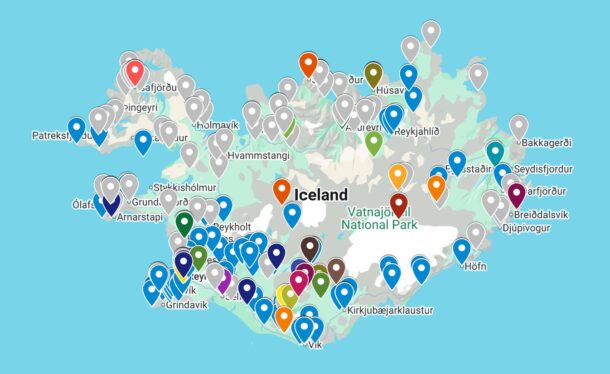
Access Our Interactive Highland Digital Map
To help you navigate this massive volcanic route confidently, we have developed a customized Camper Iceland Interactive Google Map, accessible directly on our website. This digital map features pre-pinned coordinates for safe fuel stop areas, essential highland warden cabins, scenic vistas, and the exact locations of the major unbridged river crossings along the F26.
Before you depart tomorrow morning, open our interactive map page on your tablet, download the offline regional map package via Google Maps so you preserve tracking capabilities without cellular service, check umferdin.is for the green status, and take your time. Enjoy the raw majesty of Sprengisandur safely with Camper Iceland!