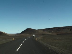
There you find the actual weather and road conditions in Iceland: https://www.campericeland.is/en/information/actual-road-condition/
Weather and road conditions:
ATTENTION! Storm expected for the next few days which will affect travel – especially since many cars are now equipped for spring/summer conditions. It‘s important to inform visitors of the dangers and conditions we have here and urge them to follow www.safetravel.is well as we issue alerts on things that have effect on people’s travel in a comprehensible way. It‘s not unlikely that the Road Administration will issue scheduled road closures for tomorrow so stay informed!
Westfjords: Bad driving conditions on mountain roads – will also affect Strandir and even as south as Brattabrekka.
Eastfjords: Early tomorrow we can expect conditions to worsen on most mountain roads. ATTENTION! Many of the passengers from the Norræna Ferry are not equipped for winter so it‘s important to inform them especially of the conditions in our country these days!
South Iceland: It‘s not unlikely that we‘ll have a sandstorm from Kirkjubæjarklaustur to Jökulsárlón and we are expecting some very strong wind gusts (up to 45 m/s, 100 mph, 160 km/hr.) from Skaftafell to Jökulsárlón and from Seljalandsfoss to Skógarfoss!
On Thursday temperatures will drop, therefore it‘s not unlikely that along with precipitation there’ll be some ice on mountain roads in the areas listed above – especially in the North.
For those who aim to hike over the next few days – the precipitation over the next few days will most likely be snow in the mountains. Layers of snow may make conditions difficult for hikers and avalanche risk may increase in some places. We are, for an example, expecting up to 2 meters of snow to collect around Hvannadalshnjúkur!
The highland roads are all impassable as usual and will stay that way until late spring or early summer! Those travelers that wish to visit the highlands must do so with a scheduled tour in a modified vehicle. We‘ve had a few incidences where visitors think that having a 4×4 vehicle is enough to do this – that‘s of course not the case! The damages can cost thousands of dollars so it‘s important to inform our guests of this! Here you can find the estimated opening times from Vegagerðin.
NOTE: Some GPS devices may lead tourists on to closed mountain roads because it determines it shorter in kilometers. In good conditions, it takes longer and at this moment they are simply impassable!
Popular tourist sites:
Roads to Landmannalaugar, through Kjölur, Sprengisandur and Kaldidalur are CLOSED. Not all these roads will be closed with a clear closure over the road so it‘s important that our visitors are informed of this.
Busses have started to go into Þórsmörk and condition on the trails are good – snow can still be found on slopes that face north. Because of glacial melt it‘s notable that river levels will rise over the next days! Getting to Langidalur and Húsadalurrequires experience with crossing bigger rivers!
The road from Geysir to Gullfoss from Tungufljót is like Swiss Cheese – a lot of pot holes and puddles that can potentially damage your car! Lower trail to Gullfoss is open yet very wet!
The 800 m. trail to Dettifoss & Selfoss is now open. Conditions are not good for hiking due to mud, big rocks and the fact that the snow is very wet and slippery (especially on slopes). Very important to follow marked trails! The trail to the new look-out is closed due to water melting and mud.
Conditions in Reynisfjara are good but due to the unpredictability of the waves, conditions are ALWAYS dangerous. It‘s not that the waves are big, it‘s the fact that they are sneaky. Every 7th, 10th or 12th wave goes a lot further up the beach than the rest and this can catch visitors by surprise that are too close to the water. The sand is very fine and the sheer pulling factor of the wave makes it easy for it to pull visitors out to sea. If you know that your guests are going there by themselves – make sure they are informed of this.
Kirkjufjara by Dyrhólaey has been CLOSED due to increased dangers in rockslides and deadly sneaker waves.
Similar danger can be found in Djúpalónssandur beach in Snæfellsnes peninsula.
Popular hiking trails:
Mt. Esja: To hike up to „The Rock“ (Steinn) is fine. Going to the top requires climbing – some ice still in the area. Proper hiking boots and warm clothes are a must due to the wind chill factor.
Skaftafell: All trails are open and in good conditions except for S3 (Skaftafellsheiði) and S4 (Kristínartindar) due to snow and mud. Trail to Morsárdalur recommended as a longer option. We recommend speaking to the wardens in the Info Center for updates. There you can also get a hiking map of the area.
Laugavegur and Fimmvörðuháls: Both these trails are closed for those who are not experienced mountaineers! There are no scheduled busses running to or from Landmannalaugar and hiking conditions in there are not good at all!
Reykjadalur: The trail is now free of snow but due to mud on the first quarter of the hike it can be slippery. Important to bring warm clothing and not underestimate this hike! Bubbling mud pots all around so hikers must watch their step!
Glymur waterfall: Landowners expect to put the log up in mid-May. Without it, hikers have to cross the river on foot which can be very dangerous when levels are rising like nowadays!
Avalanche danger: Low (level 1/5)
Low danger in mountainous areas in the Eastfjords, northern Westfjords and in Tröllaskagi peninsula. Further info can be found here: http://en.vedur.is/avalanches/forecast
